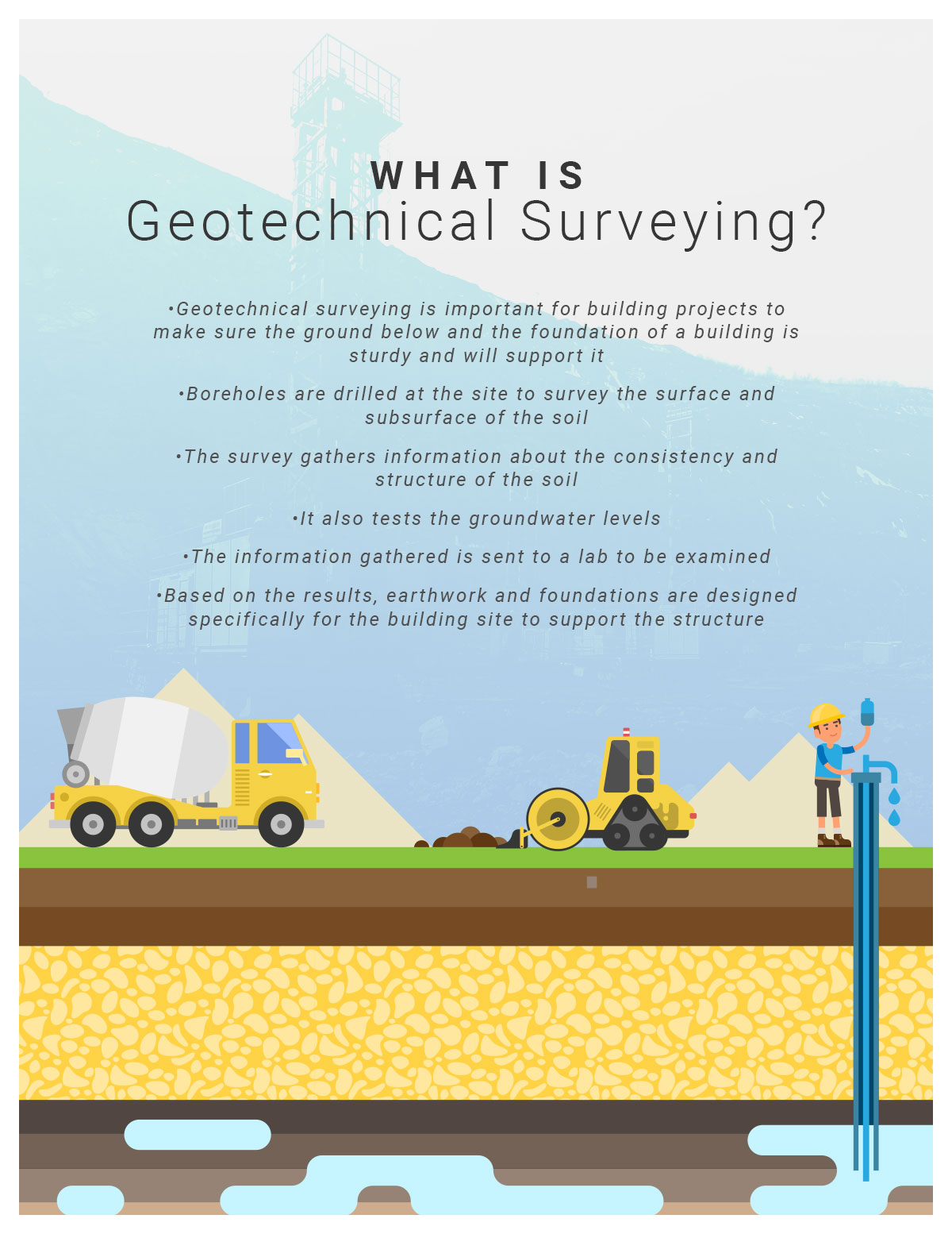
Before beginning construction on — or even purchasing — a plot of land, it’s important to understand the makeup of the ground you intend to build on. What is the consistency of the soil? How much groundwater is there? Is the soil prone to liquefaction — when the ground takes on the properties of a liquid — in the event of an earthquake? It’s important to know these characteristics so that your building is constructed on a sturdy enough surface.
This is where geotechnical surveying comes in. The process of a geotechnical survey involves testing the soil consistency and structure, groundwater level, and making recommendations for any technical project based on the results. Boreholes are drilled at the site and samples are taken from the ground and analyzed in a lab. Based on the results of this survey, recommendations for building are created.

What’s Included In A Geotechnical Survey
It’s important to include highly-specific information in a geotechnical survey. For the most accurate and complete survey, the report should include the footprint of the building, the area of land where the building will be located, how much the land slopes, how close the land is to a body of water, if it will share common walls with existing buildings, the height of the building — including the basement, ground floor, and number of floors — and the geographical location of the building.
In many cases for building projects, a geotechnical survey is required before a building permit is granted. If a project is for rehabilitation, consolidation, modernization, or the refurbishment of an old building, a geotechnical survey will need to be completed.
How A Geotechnical Survey Affects A Build
The purpose of geotechnical surveying is to design earthworks (construction of the soil) and foundations that will support the building on top of the existing soil. It also helps when recommending earthwork repairs after the subsurface of the ground has changed.
Depending on the builder, a geotechnical survey can be as simple as a visual assessment, but for more extensive projects, more tests are performed. A survey can include geophysical methods, such as testing the seismic, gravitational, magnetic, electrical, and electromagnetic activity; geologic mapping that identifies geological features of the land; and photogrammetry, the use of photos to measure distances between objects.
Geotechnical Survey Tools
To perform a geotechnical survey, you will need to hire a trained, professional, and experienced team of geotechnical engineers. For those in the mining and geotechnical industry, Bore Path Services provides the latest in directional surveying tools and equipment that can be purchased or rented for a monthly rate.
The Gyro Path® NSG is North Seeking Gyroscopic technology that can be used both horizontally and vertically. It has real-time survey applications as well as memory to save the information from a survey. It can provide precise results in under one minute. It can can also survey inside drill rods. The system also gives gyro orientations of wedges and other downhole tools.
Another geotechnical surveying tool is the Gyro Shot®. This surveying system is a six-axis, solid-state rate gyro system. It is the most rugged gyro survey system available. It can compare readings of both magnetic and gyro sensors for an even greater understanding of drilling conditions.
The MI-5 is another tool used for geotechnical surveying. It is reliable and rugged for over 15 years of use in even the most extreme drilling environments. It is a dependable device for retrieving data. It keeps data safe and saved — even throughout off-seasons.
If you’re in the mining and geotechnical industry performing surveys, it’s important to have the sturdiest and most reliable tools and devices. Get more information about directional survey technologies available from Bore Path Services for the mining and geotechnical industries. Your tools should be strong and give the most accurate information for your clients to build safe and sturdy buildings. If you’re interested, you can request a quote to purchase or rent geotechnical surveying devices and tools.
Bore Path And Geotechnical Surveying
Bore Path Services offers the best geotechnical surveying devices, systems, and tools that are durable and reliable for the quickest and most accurate information. We serve the mining and geotechnical industries, offering affordable options for purchasing or renting surveying tools. Check out our pricing philosophy for our different systems and available software. You can request a quote or reserve a rental today.